I am Zachary Pratt and this is where I will share all my hiking adventures with friends as I conquer everything in my way.

Sunday, March 16, 2014

Taylor Mountain

Well after the last instance... I needed some time...

I don't think in my life that I have ever been so angered at a hike like I was at Rattlesnake Ridge. So I knew the next one was going to have to entail something that I would enjoy and since February was a fairly close to a swimming pool, I waited and sat for a hike.

What eventually came to me was an old favorite, Taylor Mountain-Holder Ridge.

Now this is a VERY easy hike, I would put it below Poo-Poo Point on a scale of easy. We did 1,420 vertical feet in 3.23 miles. Mind you, we did some exploring but by no means was it "Hard".


You begin at the parking lot. No passes here either. Thank goodness for King County Parks.

There is particular route has two directions. Neither matter but are equal in there way.

 
I normally head up the service road but that's because I like to have view going down rather than coming up. Why have your back to a view?

The trail up is a simple service road and has no views. Which sucks because I think from that position, you'd have a good view of Tahoma (Mount Rainer). After about 1.2 miles, you come to a T in the road and take a left turn. This will take you up and up and such until you start walking along a flat surface.

From here, you can hear Highway 18 below. Not my favorite thing obviously but at the same time, I can deal. As soon as you begin going downwards, you can look straight a head and catch a small glimpse of the metropolitan area. I was never sure if it was Seattle or Bellevue but either way, it is only to be seen on a clear to semi clear day.

You come around the corner and BAM. A stellar view of Hobart, Maple Valley and beyond. You don't actually see the cities but if you know the general location, you'll have a good idea where they are.


After taking the sights in, you continue on the well worn trail. It was clear to me that it had been well used. This is considering the fact the network of 30+ miles of trails is open to access for everyone, hikers and bikers and horsemen and women a like. It's not to hard to traverse but at the same time, it can provide some ankle busting situations. SO be careful!


As you keep on meandering through the trails, you come upon another T. Your option here is to go straight, which will lead to service road again OR the path that I take which is Z backwards and keep going on the trail. At that point, you go down for a bit, and a bit and a bit and then you make a Sharpe turn up hill. Up and up so more and the over ridge and down the other side. Not much to mention after you dive back into the trees. the trail will level off and lead you back to the parking lot and that's it.


So in short, a simple hike, not much to it. It's in the same category as Poo-Poo Point. Something small and easy and is a good after work/school hike.

So now that I have that outta the way... 68,500 feet left..


AND don't forget to comment with hiking rules or if you want one a book for yourself. I think that it'll be 101 rules?


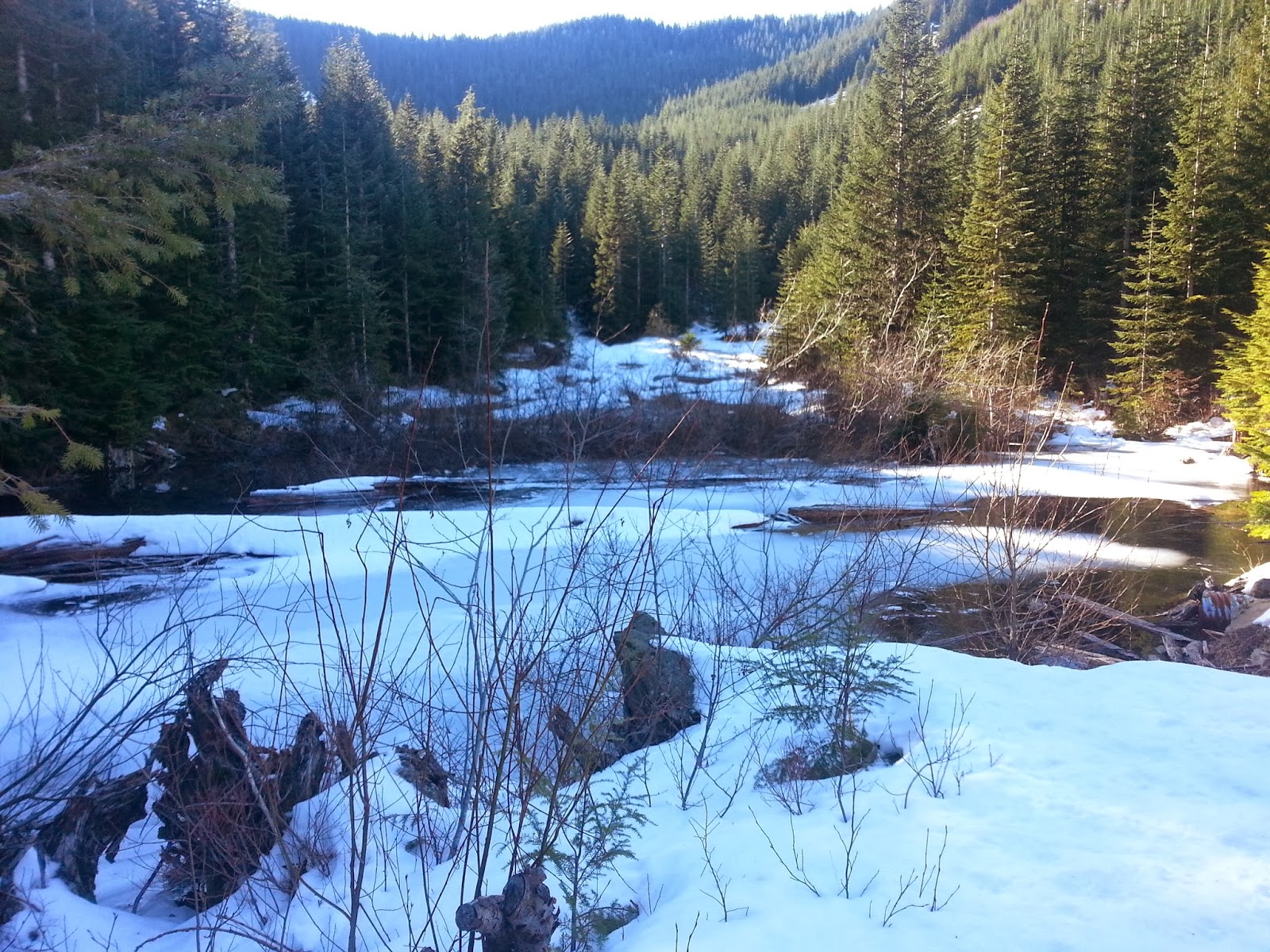
And note, the photos that I included here weren't take on the day I hiked they're about 2 years old.

Thursday, March 13, 2014

A Tribute

A little back ground on me and you'll find that I suffered some life changing events during middle school, I won't go much into detail but just know that it wasn't the lovable saunter you see today. In 2011, I had just recently gotten out of a relationship and was experience another depressions swing. Next to out of no where, my now right hand hiking partner, Noah Hebert, asked to spend the day with me and we decided to go for a hike. That hike happened to be Mount Si, a local favorite. After a long slog up the hill (which is what I now deem it), we reached what is considered the summit. This in reality is not the summit due to there being an extra 250 foot climb to the true summit. Many people stop here BUT being the young ambitious people we are, we decided to climb the "Haystack". We got about 75-100 feet up and it began to RAIN and I don't mean rain, I mean the gully we were climbing turned into a waterfall... and we're half way up.. With no ropes or guards to falling. We began the rapid/careful decent down and arrived back at the summit plane soaked to the bone but were laughing at our silly mistake. As we toured back down the hill side, I couldn't help but feel that I was happy for once. I felt that I could do something and beat it, despite to this day, still not having actually "summited" it and having a strong disposition to busy hikes, Mount Si started it all for me. After Si, It was a common thing to push the elevation higher and high and go further and further into the wild.


 So whats this all mean? Well that is my beginning. With out Si or Noah,who knows where I'd be in life?

Hiking is my escape, It allows me to be free. As the old Times Magazine motto goes,


"To see the World, things dangerous to come to. To see behind walls, draw closer, to find each other and to feel. That is the purpose of life"


I live by this every day and believe in it truly


I would have likely gone down an much different path in life. I would have never become more active, I would have like stayed in a depressed state for longer and who knows frankly?

I thank everyone who's helped me along this amazing journey and just wanted to give thanks to the support given to me.

Wednesday, March 12, 2014

Rattlesnake Ridge-East Peak

I have a hike I hate


Which is scarey because I love hiking and always have and always will


So in all my hiking, I must admit that at any rate.. I have some prejudice when it comes to hiking.

I avoid hikes. It's at any rate, not something I try to do BUT when you have a mentality like mine, it is meh.

Now by avoid hikes, I mean popular ones.

Now what is a popular hike? Well this exact hike, Rattlesnake Ridge, is a popular hike...

NOT my fault we went here but that is another story.

Anyways. The hike begins at a semi large lake's parking ground. We arrived at about 9:00 AM and boy was there a lot of people AND I MEAN A LOT. The parking lot is pretty good sized and was FULL. Which made parking a lot of fun to find but since this is a hiking blog, my suggestion here is to get there early.

You begin at the "trail head" which I assume is a forest service road. If you can't find it, then simply follow the crowds. It's a small walk to the actual trail. There are a couple porta potty's there which are apparently being changed into stationary toilets. The trail head looks to have been Tailor made to look like a hike. You begin walking up the trail and it gets obvious. Looks can be deceiving. As you walk to and fro, the trail does occasionally look like it splits off but stay on the most beaten part. So long as you a come up to a tree over the trail. Either duck over or under, hikers discretion. I think it was placed there to make it "challenging".

You begin going up and up and blah blah blah. It's all minor switch backs and for anyone looking for a challenge, it isn't enough to even raise a heart beat above a reasonable level.

You hit a straight point and after about 3 minutes of going straight you reach the first ledge. I admit, the view is cool. Not many view like that around here. Rather than doubling back like most were, we continued up the trail. We found less and less people as we went and I image that's how it always is

We continued toward the peak  through the woods. Not many views or a description here. It's mostly trees dirt and what not. To be frank... It's boring

I won't continue on but just know, unless you hike this EARLY EARLY EARLY, it won't be worth it...


I know this took me nearly 2 months to post but I could never actually sit down and type with out getting angered about this...


More to come soon... Taylor Mountain-Holder Knob, Mount Peak (Pinnacle peak) and the Mud Mountain Dam trail.


Also am working on a hiking rules book, check out our blog about our rules to maybe add some of your own and I'll include them in the book or even a order for a book? Insert shameless plug here...

Til next time, keep calm and hike on.

Hiking rules

20 rules.... For now...


Rule 1

Death by gardener snake would be the worst way to die\

Rule 2

Girls are always going up while I'm going down

Rule 3

Ice axes will make things more interesting

Rule four

Roots are evil

Rule 5

Trail running can be dirty dirty

Rule 6

If you don't know where you're going, it's Narnia

Rule 7

Birds like my nuts

Rule 8

Lake Serene=Heaven

Rule 9

Trick people with a wolf dog

Rule 10

Days I can't hike are ALWAYS SUNNY

Rule 11

Vertigo is bad

Rule 12

Preparation, Preparation, Preparations

Rule 13

Don't go climbing water falls

Rule 14

If it's worth doing, its worth over doing

Rule 15

Saunter, don't hike

Rule 16

VOODOO ROCKS can be odd

Rule 17

Silence is golden

Rule 18

Find a short easy hike... For warm ups of course

Rule 19

Pick up where others left off

Rule 20

If it looks like a trail... It likely is...

Wednesday, January 29, 2014

Mount Washington

 
I am late only for a second time but this time, I am at least less than a week off.

This is Mount Washington over looking the Snoqualmie Valley on the south side. Many people go for the North end hikes like Little Si, Big Si, Mailbox Peak and what not but I wanted to change it up. In my reading, I found this this and ultimately decided to go for broke.

A few Minor issues, were merely finding the trail and hoping it wasn't to out of the way.

The trail starts after your first right into Olallie state park. The parking lot isn't anything special besides dirt, a couple signs and a initial trail. Its from the trail that you begin. It's small. Very small. You then pop out on to what is like a forest service road. A fork in the road is then met and you continue straight. As you keep going you'll pass a sign saying John Wayne Pioneer Trail. About a hundred yards after, you'll come across a "Trail". This is the actual trail. If it looks like it than it probably is and with that the UP begins.
Not much of a trail...
Now we're getting some where

Small view

This isn't to particularly hard. You'll be greeted occasionally by interesting sheer rock faces and some views although not much. I had some problems when asked how high up we were because I couldn't get a good look at other mountains to guesstimate.

At about a mile you'll come to a rock face with an opening in the bottom. Attached to the rocks are many hooks which I assume is used for rock climbing
although why they're at a point in which people would be upside, I don't know but exploring the mini cave was a fun side trip as I got to tell my girlfriend(who was occupying me again) about erosion processes and the likely formation of the rock(being an avid person of geology myself.)
 
Not sure why you would hang your self upside down but OK...
 
 
After leaving the little side trip, the up factor kept going. I, in all honesty, was a little worried that I had put us on the wrong trail, due to there not being any signs about it. We reached a clearing at about 2,500 feet and took a small break. Observing the East side of Rattlesnake Mountain, I failed to realize we were in the exact spot we needed to be in. What we had came to was the Owl Lookout spot. Back in the day, the local Mountaineers would do evening hikes to the location to observe owls flying about above the land. Now it is more of a location for the unhearty to turn around but I wasn't gonna let the break deter me any so we forged on. As we kept going up, we reached a small plateau in which I found a sign pointing to Mount WA. I breathed a sigh of relief as I knew we were in the right spot. We took the right and kept on. We had to hop across a creek not once but twice both were pretty full due to the snow around. Now there wasn't a lot but it was ice which made the going slow.
Looking out from "Owl Point"

and so it begins...


We arrived at a small pong and had another breather. I was looking for a small rock pile while my girlfriend snapped a few pictures lucky for us, it was sticking out of the snow and we continued down that direction and up still.
Cute little pond

THANK YOU
 

 As you go, you wrap around the dark side of a valley, still trudging in snow and pretty much stay in the snow the rest of the way. As we turned a corner and faced north, I caught sight of the little seen Glacier Peak and some snow.
 
McClellan Butte
Sun+Snow=BRIGHT


Coming around a bend again you get an awesome view of the Snoqualmie Valley. Now fooled by me, my girlfriend thought we were done but ho-ho ho little did she know. I turned and pointed up and she saw the true summit just a few hundred feet above. With a heavy sigh she set off ahead of me.

Hmmm Are these climbable?
Summits up there, now push!

Well we got onto a service road and continued on. We came to another open space and was greeted with a no trespassing sign. This I knew was going to be here because the backside of the mountain is on the north side of the little seen Cedar River Watershed. Thankfully, rather than shoot up a steep gulch, we went down the road. I had contacted a man at the Seattle Public Utility's the day before and found that so long as you don't go bombing down to the lake. So we got to another opening and I snapped a few pictures of the rarely seen lakes

Masonry pool

Miss Tahoma Showing off


and we began an up hill push to the end


Now the thing about this hike is that you don't realize you're at the summit until you're there but let me just say. Hot damn it was worth it.

 
To be honest.. This is the only view that matters(lots of trees at the summit)


Now funny story about the flag. The night before the Seattle Seahawks had won the NFC Championship and I thought that for the heck of it... Why not claim Mount WASHINGTON for the 12th man? Well that's exactly what I did. In fact this picture has even now is to be featured on Q-13 Fox News this morning in sending it into my favorite weather women.
So we finished with an U-RAH


What a hike it was.

I found it incredibly amazing to gain a different view on the valley so commonly hiked and especially since the climb wasn't to terribly hard. I think on the way back we saw maybe 4 hiking party's of about 20 or so people. It is defiantly a nice escape from Si or Mailbox and will defiantly be done by me again.

74,415 feet left

Poo-Poo point

So I am a tad bit late on this one but I suppose better late than never (Hiked on 1/3/2014)

The first hike I did of 2014 was a very small "mountain" named Poo-Poo Point. It lays at the west edge of the Tiger Mountain Forest. Which ironically, I've lived in Washington for awhile and I have actually never done the classic Tiger Mountain. Poo-Poo Point on the other hand is a small hike that isn't to terrible hard but will make you work a bit to get a view.


The first step of 2014

You start out at a parking lot off a busy road leading from Maple Valley/Hobart to Issaquah. The funny part about it is that the parking lot is apart of a spot for hang gliders to land. In fact that what Poo-Poo is, a Hand glider launch point. The day that my girlfriend and I were there, it was quiet foggy. That seemed to be the trend with the hike considering it was a year before when I did it the first time. You cross the Landing Zone after seeing many signs warning to look up. The trail is pretty basic but surprisingly for as much as it is traveled, the trail does have some pretty rough spots. This makes for an interesting time because you are occasionally climbing over roots and rocks that would not be expected on a pretty well used hike. We continued onward climbing up and up and finally broke through the fog. Getting some what of a view. We got to a point in which I finally gave my partner a break. Knowing my goal of 80,000 vertical feet gained through 2014, I am one to push myself and the ones who are coming along. At the same time, I realized I was quiet out of shape, taking the holidays off to not worry much about hiking.
Getting above the fog
 
Kris siting back
 

We kept going up and the trail opens up a bit more. I believe it maybe the cedar trees causing this. I'm not biologist so don't ask... You keep going until you smash through the trees and open into a clear cut. At first it's kinda shocking because it's unexpected but then you begin to climb up to the top and find that it is likely used for paragliding jump spot. A smaller white sign is on the ground giving you a number and business name if you are curious about hurling yourself off a mountain, since it wasn't my cup of tea, we continued on. After another small jaunt through the woods, you begin to go up and up and up and finally break through trees. There seems to almost be a light at the end of the trees but it really the actual summit. As you come through the trees, you look north and are able to see the town of Issaquah and lake Sammamish, to the south is a iffy view of Maple Valley and possible northern reaches of Kent/Auburn and across the way is Cougar Mountain.

The summit view

Weather station

Looking on
Another significant part, at least to me is the presence of two very "official" looking devices on the top end of the hill. The tall tower is a weather monitoring device. It's most like for the people who jump off the mountains. The second and more curious device is a solar panel and small capped object on a tripod. This is what basically is GPS station. There is a scientific name for it but most people wouldn't understand. The metal rods go down into the earth about 30 feet and that about it. The device is really cool though because it measures the movement of earths tectonics plates by the thousandths. I believe that the device was placed there by Central Washington University and the University of Washington.

The set up
To go back mealy retrace your steps. On a clear day, on the first summit, there is a slight view of Mount Rainer, or as I better call it by its real name Tahoma. Today wasn't the case but it was a good hike none the less. Nothing to serious and a good way to start my year off. Would be something to do on an unbusy day of the week or a rainy day. We saw 4 people besides us the entire day. In my opinion a simple hike for a simple day.

That leaves 78,225 feet left

Guess whos back?

Everyone to everyone.
So this maybe "just another blog" but I find the prospect of sharing my adventures with the world to be an almost desirable thing to do.
A lot of people may not even go out in the way I do. I have many major goals for my hiking, which is what this blog is and will be for that. I'll include my travels as well a set of rules that my fellow hikers and I learn about during our time in nature. I hope to eventually make this a book eventually and who knows where it'll end up at.
And this time.. I'll be bringing some friends


For all of you from me, I hope you enjoy
"To see the world, Things dangerous to come to, to see each other and to feel. That is the meaning of life"


http://www.youtube.com/watch?v=nxpTx0VDBKw