I am Zachary Pratt and this is where I will share all my hiking adventures with friends as I conquer everything in my way.

Saturday, July 19, 2014

Prismatic Springs-6/23/14

 
150 feet on a board walk.... This is literally riding the line between a walk and hike..
.
THIS WAS SO OUT OF CHARACTER FOR ME. If you follow my hiking her say or what not, you must know by now... I HATE CROWDED AREAS. Yellowstone is more than a crowd... It is a testament to the park rangers whom so gracefully keep the park in excellent condition BUT GET SCHOOLED BY YOURS TRULY. *cough cough* Sorry... Lets be official here....
 
 
A naturally beautiful area as the Prismatic Springs are is a true area in which is proof that Yellowstone's beating volcanic heart is truly alive and well. The vibrant colors of each spring which are full of micro-organisms which only exist at this heated state and are thought to be the single celled organisms that began the long process of morphing into EVERYTHING you see, know, touch and what not. It truly is a humbling area to know that is what primordial earth looked like. Most people, standing in this spot do not realize that below their feet is a volcano big enough to kill humanity(99% of them are focused on the animals of the area) and are blissfully unaware BUT if you ever go, take a minute, look about, and realize that.


 

Borah Peak-6/21/2014

3,750 gained
 
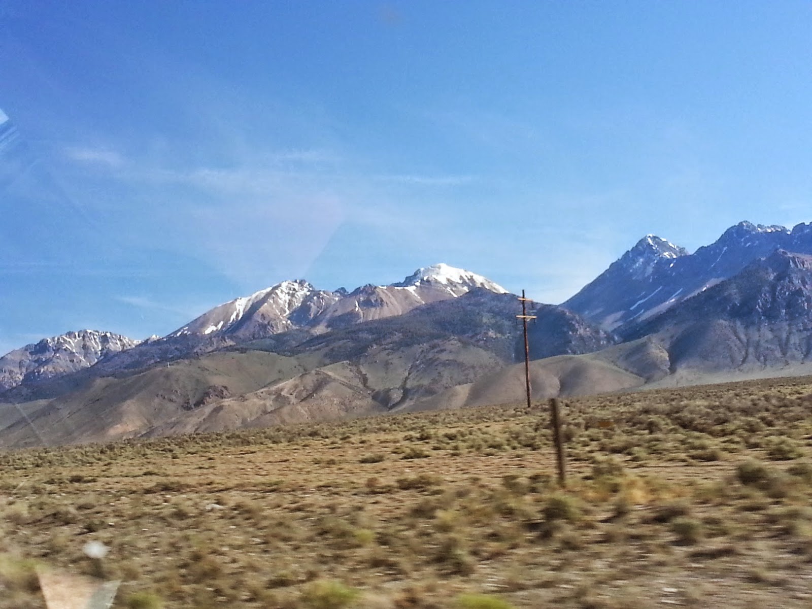
Does when in Rome count when hiking? Although I did not successfully summit due to the areas chronic wind issue, I did find that I am able to function above Mount St. Helens height of 8,366 feet. In Fact, up to 10,000 feet(which is where I stopped due to a 35 MPH coming from no where). The trailhead begins after a friendly jaunt on a gravel road which leads you to the base of Borah. The dirt hits the fan as the UP begins nearly instantaneously from leaving the safety of the parking lot. In fact.. This is such an UPPITY TRAIL, the up begins in the dang parking lot and it D.O.E.S.N.O.T end. As the dust trail unfolds, you cross what looks to be a creek during the rainy season and after more UP you breach a small ridge and wait for it... YOU FIND MORE INTENSE UP. The views of the valley below where absolutely spectacular. I kept going up when I found myself counting the switch backs and stopping for a 30 second breather. I'd stop after every 5 when after 20, I looked up and said some very colorful words to myself, and only myself due to being alone. A long stretch of UP remained in my way. I held my breath and sighed and moved. I rounded a bend and became seriously exposed on all sides. A weeeeeeh bit of vertigo appeared but I recovered and sat down for lunch at 9,340 feet, or so my GPS said. I eyed up the mountain and charted my route UP the talus. After a filling lunch, I began the UP and UP and UP and UP until I reached the all mighty 10,000 feet. At 10,000 feet, I turned and mouth agape, stared into the empty space. While I picked my mouth off the ground I noted dark rain clouds to my west. I turned to continue UP but was blasted in the back by a sudden 35 MPH gust of wind. After picking up and brushing my hat off, I knew the weather was changing and, against my best wishes, decided to go back. I ducked back under the tree line and found my self smiling, knowing that I had made a good choice and would live to hike another day. Sadly, I didn't add the summit of the 12,667 foot mountain to my summited list but my grandma gave me permission to knock it off my list to climb all 50 states highest points. So Mount Borah of Idaho. #11 off, 49 to GO.


Sunset Cone-6/27/14

1,101 feet gained
 
A spur hike I had been very well wanted to do. Another cinder cone that was on my hit list. I began at the Craters of the Moon info center to obtain a backcountry permit through the National Parks site. I must say... The whole system is wonky.. After leaving the park and dashing across the highway and nearly losing my hat as a hay truck blew by me at 75 (speed limit out there being that). I got down the road to the forest service entrance and grinned. Truly my kinda hike. Nobody around for a long while plus a mountain in by way. I went down the lonely road with stellar view of the Lost River Valley to my right. I came around to a group campsite and found myself staring at the long cone and not seeing a way up, I just started going. It was a strong case of path of least resistance and go. Eventually, near the "tree line"(not exactly...) I did find what looked to be a game trail so I followed. It lead me directly to the summit ridge and from there It was an easy hike to the summit. Atop the volcanic cone you truly do get perspective to how large and expansive the area of the semi-lifeless land ahead. I had true sight of the visitor center from the top and I didn't feel like going back the way I came, so it was down the sage brush infested south side facing the center. I'm sure my bright red shirt stuck out among the browned ground. More then likely got some odd looks but neither a black widow or Rattlesnake came out and got me so... I guess for the win?


Thursday, July 17, 2014

Caves of Craters of the Moon

6/20/2014: 400 feet gained

A new experience for me. Four caves were accessible to the public and me. To get to the former lava tubes, one must travel across the barren landscape. A normally easy task with the relatively flat land, I noted the temperature rising on the blacked land. We arrived at the first cave. I can't really say it was a cave however due to when I climbed in I was met with a sign stating there was a rock fall near the entrance. Shining my light ahead I caught it and back out. Traveling a bit further we found a second, much larger but less accessible cave. I climbed through the first sky light and walked a couple hundred feet to where I found it to be very quiet and lonely. The sides dripped with former pot parks of where the less than viscous lava had once used the tubes to pressurize and flow with ferocity under ground and fire itself out of the ground when it hit a block. I came to the next skylight and found grandma on the cave floor and grandpa eying coming down. I tempted him to come and we decided to go . Despite my grandparents not being able to hike to my degree, they kept up as I twirled around and lightly jogged between both sides of the cave looking at all the geology of the area. We passed under another sky light and found a way out. After helping both grandparents up and crawling a bit more, we emerged in hell. We had found yourself in the middle of a 2,200 year old lava flow. Truly hell, as black and lifeless it could be, We eventually did find the route back to the junction with the main trail and I decided to forge on. My curiosity had been ticked by a cave said to have ice in its deep hollows. I found the yawning hole and drove in, crawling on my stomach for a good portion of the entrance, I found the temperature to be about 25-30 degrees. A very stark contrast to the 80 degrees and building temperature outside. I climbed through finding the ice and what not then went back outside to find another cavern. Stepping inside, I nearly took my ankles out twice, nearly stepping on what looked to be former fissures. Not that they'd do to much but I didn't want to risk it. I reached the end of the rock fallen cave and turned around. I approached into the sun and sauntered back through the eerily beautiful world.


Inferno Peak-6/20/2014


1000 feet gained

After entering the barren land scape of Craters of the Moon and following a "hidden road"(They tried to blend the asphalt color with the surrounding volcanic rock) we arrived at a pull off and Inferno Cone. The grandparents and I decided to jaunt up as they looked for a path, in my all mighty glory, said GO and up the Cinder cones flanks I rushed with the grandparents in tow. Upon summiting the stereotypical Cinder Cone, The empty land was truly put into perspective for us as you could see for miles and miles with little(One smaller cone to the south) to absolutely no obstruction.


OSHC-Oregon Trail: 6/17/2014


 6/17/2014- 950 feet gained


At any rate, nothing large, wouldn't even consider it a warm up trail. Easy trail to follow from the Oregon Trail visiting center in Oregon. When you reach the base of the large hill it sites on you find a canvas covered wagon that sits alone, almost frozen in time. From there, you begin to follow the actual Oregon trail this is occasionally potmarked by wagon ruts. Up small trail and we were back on the road to be picked up by grandpa.

Thursday, April 3, 2014

The Cursed Blessing

Well kinda a depressing topic this week but I feel it needs to be addressed

If you have ever had to lead a hike or mountaineering group or what ever, no matter if you realize it or not. You carry a MAJOR load of responsibility. From having people trust you to know the route to knowing the basic medical. A lot needs to be learned and be taken into consideration by a guide. That responsobility can be a burrden some times.

And don't get me wrong. I love being able to include my friends on hikes but the one thing that many don't understand is that there is a bit of pressure, even if you aren't going up something like Tahoma, a simple slip of the foot can result in a broken ankle. That always rings in the back of my mind while hiking.

Maybe it is just me being a worried person but I feel like it is a cursed blessing. On one side of the tracks, you have someone trusting you to lead them into their unknown and trusting you in your skills to get them back safely but as someone who has said experience. I don't know. I may not make it vocal but I believe this is something that guides need to have in there head and if YOU are on a guided tour and they aren't concerned for your safety. I'd politely back off, just because I wanna live.


Who knows though.. Some function under that pressure.